Danube river – hydrology

Data sources:
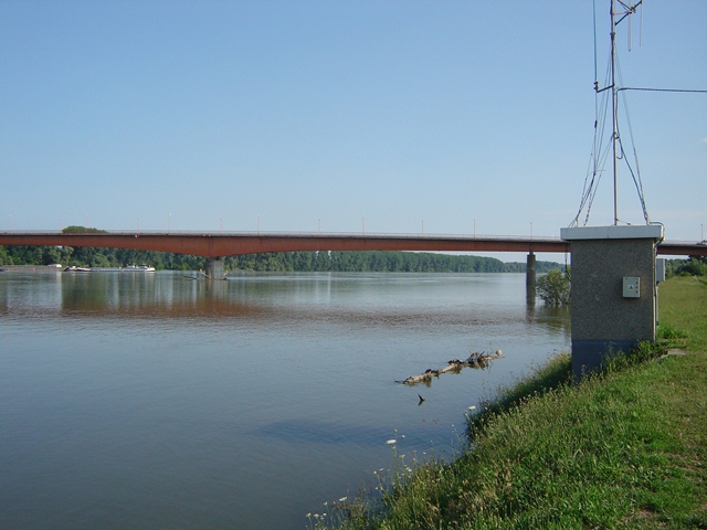
The Danube River, spanning 2,850 kilometers, forms the eastern border of Liberland, running alongside Serbia. This vital international waterway passing through or bordering Austria, Slovakia, Hungary, Croatia, Liberland, Serbia, Romania, Bulgaria, Moldova, and Ukraine, before reaching the Black Sea. Along its Liberland border, it typically measures 300 to 600 meters in width, serving as a crucial natural boundary and transportation route.
Below you can find some useful data like height of the Danube next to and around Liberland, on links you can find water flow, temperature, rate of rising or falling. Hydrology data are extracted from Croatian, Serbian and Hungarian hydrometeorology sites.
LEO is striving to promptly furnish independent hydrological data gathered directly from a test point within Liberland.
Hydrology – Serbia
Source: Republic Hydrometeorological Service of Serbia
Bezdan


Change of water stage: cm
River flow: m3/s
Water temperature: °C


Apatin

Change of water stage: cm
River flow: m3/s
Water temperature: °C


Hydrology Croatia
Source: Croatian Meteorological and Hydrological Service
Batina
Hydrology Hunagary
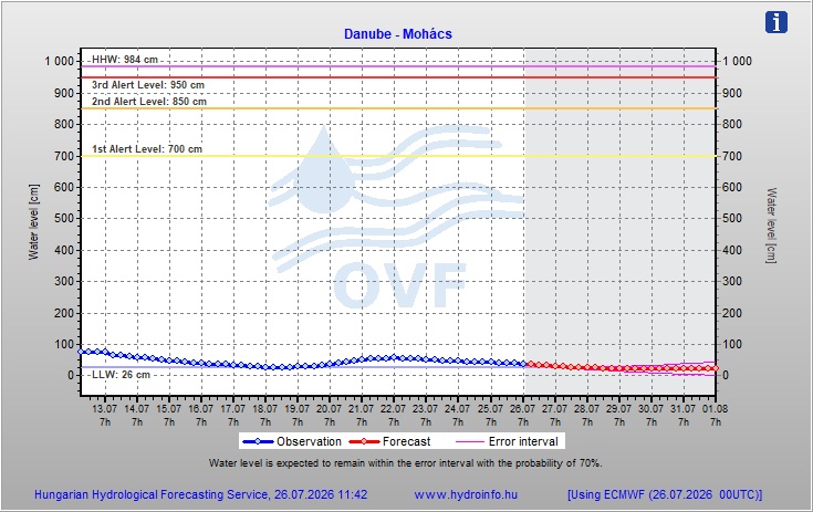
Source: Hungarian Hydrological Forecasting Service
Mohacs